You know that saying “when it rains it pours”? Well, it has been pouring here in the Coachella Valley all through the night and all damn day. No mercy from the rain gods…road closures, swift water rescues, flash floods in the canyons and roads washing out high up in the San Jacinto Mountain communities.
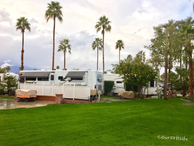
The water hazards on the golf courses here at the Outdoor Resort are now giant lakes!!! In the big picture all is well here at the Outdoor Resort. There isn’t much outdoor recreation going on here today but at least the ducks and geese are happy.

Road closures all around the Coachella Valley
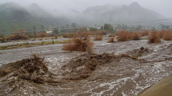
This wash was completely dry on Wednesday.
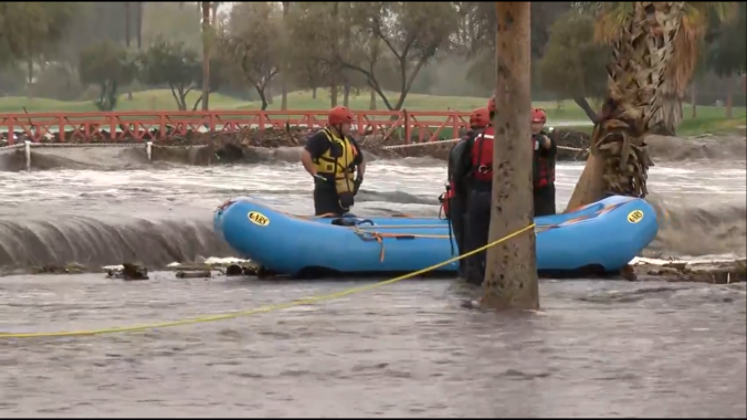
So thankfully for all the trained professionals who are out rescuing people.
According to the Palm Springs Visitors Center, rainfall is almost non-existent and the humidity is low in the Palm Springs area, reflecting the minimal annual rainfall total in Palm Springs is limited to about 5.8 inches, with 10 or fewer days each year during which rain actually falls in Palm Springs, Ca.
Well, I am happy to report that today we have had 3.59 inches so far making it the 3rd wettest day in Palm Springs history. But Palm Springs isn’t the only city seeing heavy rainfall. Other parts of the desert are experiencing wet conditions including Rancho Mirage, Palm Desert and other surrounding cities. Many roads and events throughout the valley are being closed and canceled.
Some fellow RV friends who are on the other side of the San Jacinto Mountains in Aguanga sent me this video today. It was taken at the road coming into their RV Resort…Nope, they are going anywhere soon!
I did make it out and down the street this morning about a half a mile to the store with only a few water crossings.

Palm Springs officials have since been asked residents to “shelter in place” as emergency services have been “heavily impacted.” That said, thankfully we are high and dry here at the Outdoor Resort! Our plan is to shelter in place at some friends who are renting a place nearby, cook a big Valentines Day dinner feast and drink some really good wine. Raingeddon be damned!

Woo-Hoo, some blue skies are finally peeking out.
We usually have a beautiful mountain view but all you can see are clouds today.
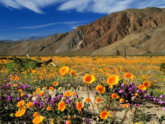
The upside to all this rainfall is that the valley should have a amazing wildflower season. According to the Anza-Borrego Foundation, this winter’s rainfalls, the heaviest in a decade in the area, have wildflower experts predicting a record bloom at the state park.
WILD FLOWERS… perhaps there is a silver lining!


Glad you didn’t float away. The flowers are great.
LikeLike
It has been a very wet and cold winter in Phoenix and the wildflowers are starting to pop up. Should be a great wildflower season.
LikeLiked by 1 person
This footage is so scary to see. What will the lasting impact be? It seems like the erosion will be extreme and will expose roots that when not buried, will lead to plant death. Happy to hear that it sounds like people and pets have stayed safe.
LikeLike
The good news is that many of those raging torrent are in dry washes that are designated as stormwater protection.
Within Coachella Valley boundaries there are 16 stormwater protection channels. The entire system includes approximately 135 miles of channels built along the natural alignment of dry creeks that naturally flow from the surrounding mountains into the Whitewater River.
Along with the channels, a number of dikes and levees have been designed and built to collect rapidly flowing flood water as it pours from the adjacent mountains onto the valley floor. These are mostly located in the cove communities.
The backbone of the stormwater protection system is a 50-mile storm channel that runs from the Whitewater area north of Palm Springs to the Salton Sea. The western half of the channel runs along the natural alignment of the Whitewater River that cuts diagonally across the valley to Point Happy in La Quinta (near Highway 111 and Washington Street). Because the riverbed flattens out naturally in the eastern valley, downstream from Point Happy a man-made storm channel funnels flood waters to the Salton Sea.
The channel was built to withstand a standard project flood, or approximately a flow of 80,000 cubic feet per second. A standard project flood is greater than a 100-year flood. Not sure what the flow was in some of those channels during the raingeddon but most of the channels sure did their job.
LikeLike